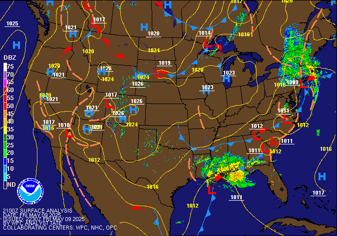


THE NEXT 24 HOURS:
TONIGHT
Tonight Cloudy. showers with a chance of thunderstorms after midnight. some thunderstorms may produce heavy rainfall after midnight. warmer with lows in the upper 60s. southeast winds 5 to10 mph. chance of rain 80 percent.
SUNDAY
Sunday Patchy fog in the morning. mostly cloudy with showers with a chance of thunderstorms in the morning, then mostly sunny in the afternoon. some thunderstorms may produce heavy rainfall in the morning. humid with highs in the lower 80s. southwest winds around 5 mph, becoming northwest around 5 mph in the afternoon. chance of rain 90 percent.
| MEASURE | CURRENT | MAX/MIN | RATE | ||||
| Temperature | 70.0°F | 84.3°F at 3:39 PM 58.7°F at 5:44 AM |
-0.6 °F /hr | ||||
| Humidity | 77% | 96% at 8:00 AM 50% at 2:36 PM |
+2% /hr | ||||
| Pressure | 30.01 in. | 30.100 in. at 10:37 AM 30.008 in. at 10:55 PM |
-0.022in./hr Falling slowly |
||||
| Wind | 0.2 mph SW | Last hour: 4.0 mph E Max day: 12.0 mph W |
Calm | ||||
| Rain - | 0.00 in. | 1 day(s) without rain Month Rain: 1.52 in. |
0.00 /hr 0.00 in. /3 hr |
||||
|
|||||||